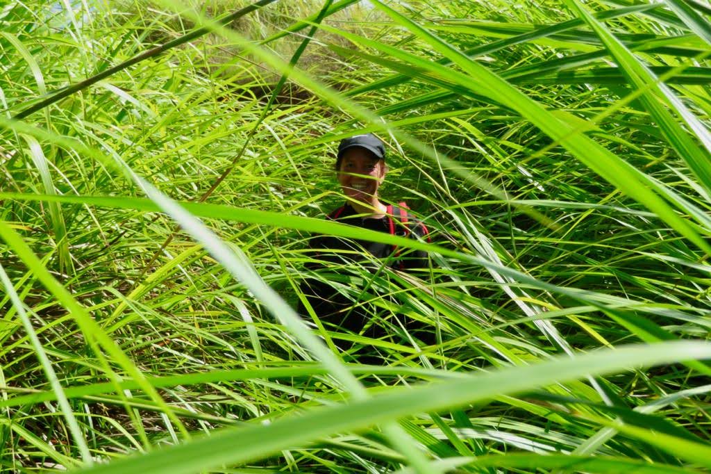
Southern Mountains. I debated if I should categorize this hike as the “harder stuff” or here. Even though I did it three times, just calling it hard does not do it justice. It took us 9 hours to go 8 miles the first time and 8 hours the second time. It was overcast most of the day and I drank 3 ½ litters of water. The next day my upper body hurt due to the hours of pushing the sword grass out of my way (think about swimming the breast stroke for hours). That said, it was unbelievably beautiful and I am so glad I did it. It was a much easier hike during the dry season. Start as early as you can. It makes all of the difference. The first time we started around 6 am, and the second time at 515 am. Not only is the sunrise breathtaking, but you can make more mileage before the sun starts to sap your energy. Make sure to wear long pants, long sleeves, sunglasses, a hat and gloves. Bring lots of water and snacks. If you start before the sunrise, bring a head lamp or flash light. There are several end points. We ended at Priest Pools which makes for a great relaxing way to end the day. Overall, this hike was much easier in dry season than wet season.

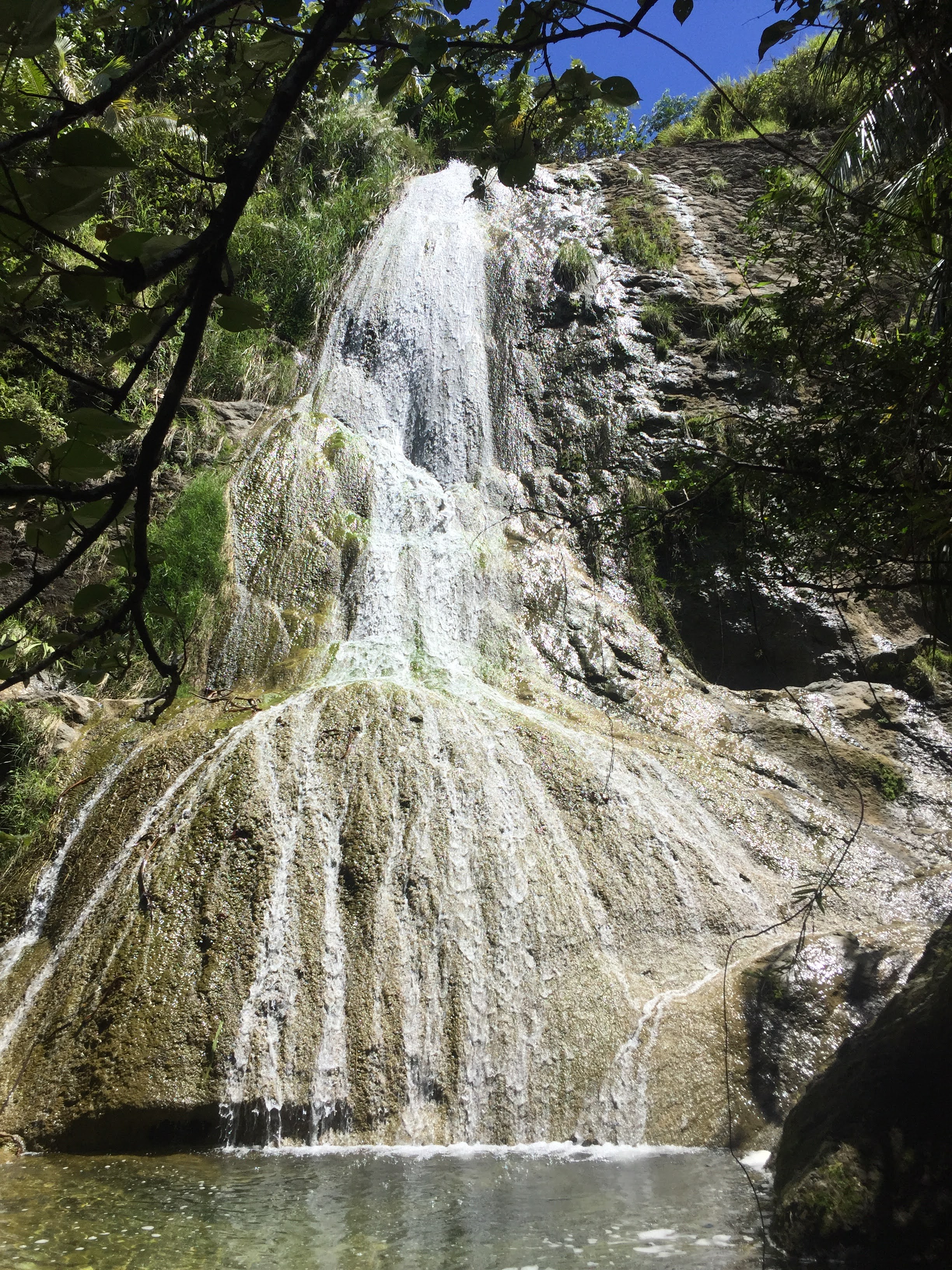
Cetti 7. The Cetti 7 is a brutal hike. Start at the Cetti Overlook and on the right over the guard rail you will see a small path. This is it. It starts with a steep decline. Make sure you are wearing sturdy shoes, pants, long sleeves and gloves. The sword grass is deep on this hike. We lost the trail for a bit, but as long as you are headed down towards the palm trees you are good. When you hit the river, go left for the falls (right for the bay). Hike up river for a while. Just plan on getting your shoes wet. I tried to avoid it for a bit but it isn’t worth the extra effort. The falls are spectacular. And because this is a lesser done trail you will probably have it to yourself. You now have 3 choices: 1) go back the way you came. 2) climb up the falls. 3) go around the falls. For options 2 and 3, this is the first of 7 falls. There is a trail on your right that goes around the first falls. But once you start climbing up falls #2 you are committed. There are no trails around them, the terrain is rough and the sword grass is thick! I found climbing the falls very difficult. I made one bad step and slipped which utterly sapped my strength to regain my footing. I was then spent. Cetti Falls and Cetti Bay are great hikes. Cetti 7 should be done with caution.
Mt Sasalaguan is on the SE part of the island. There are a ton of magnificent hikes in the area and unless you are in Guam for an extended period of time, I don’t think this is worth it. The trailhead is difficult to find and even more difficult to stay on. The hills offer some stunning views but also some horrible sword grass. We got terribly lost and I hear this is not unusual.
1000 Steps is a shorter alternative to Anao. The views are similar (aka amazing) and the hike is much shorter (less than an hour there and back). The trailhead is pretty junky and the trail is mostly rock and concrete which was a little slick in the humidity (and could be horrible in the rain). It is only how slick the rocks are that concerns me for children and dogs. I say pass on this hike. Pagat and Anao are much prettier! GPS for trailhead is: 13.4676, 144.84918

Marbo Caves is not so much of a hike as a short walk in flip flops to a cave used as a local swimming cave and a little further on for a great view. This is a local favorite for both children and adults. It can get very busy. It might be a great place to go with small children. But if you want a refreshing swim in a cave then earn it by hiking into Pagat.
Tanguisson Beach to Shark’s Hole is an easy beach walk through the water. Drive to Tanguisson Beach and head north along the shore line. Tanguisson is probably busy but once you start out you will feel like you are the first person to ever explore this shoreline. Look out for the pink tape along the jungle as you can explore and find some ancient latte stones. It was really the Latte Stones that made this an enjoyable hike. I recommend water shoes instead of sandals – the sand starts to rub and forms pretty big blisters. Follow your adventure with a meal at nearby Two Lover’s Point or Tumon.

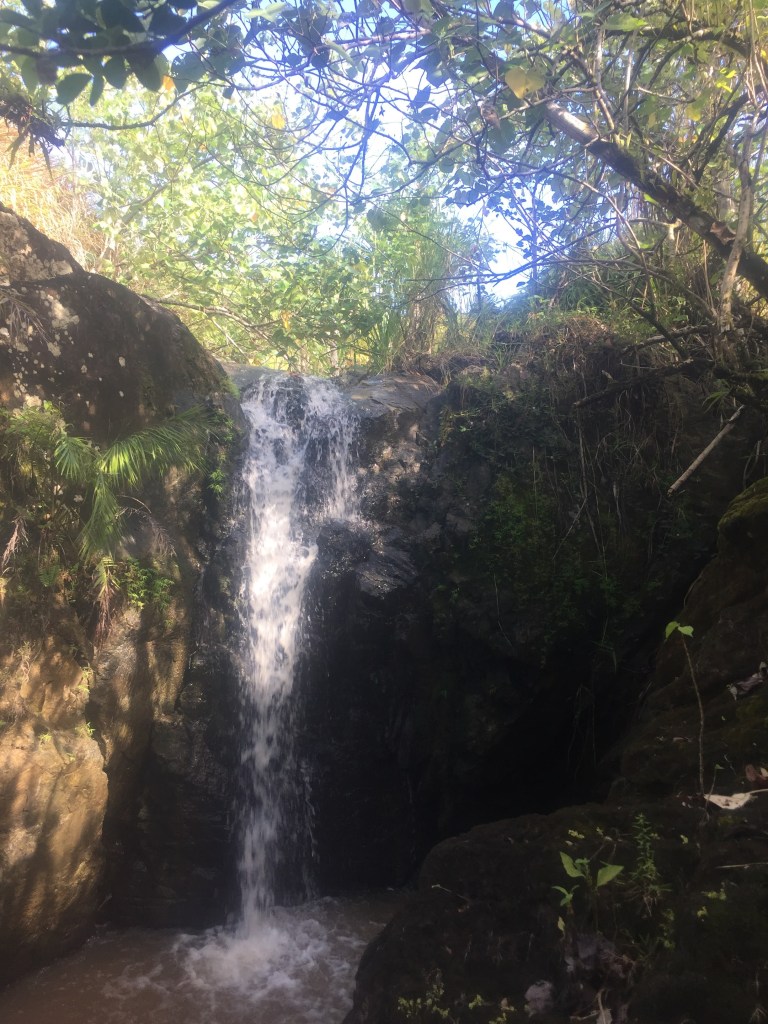
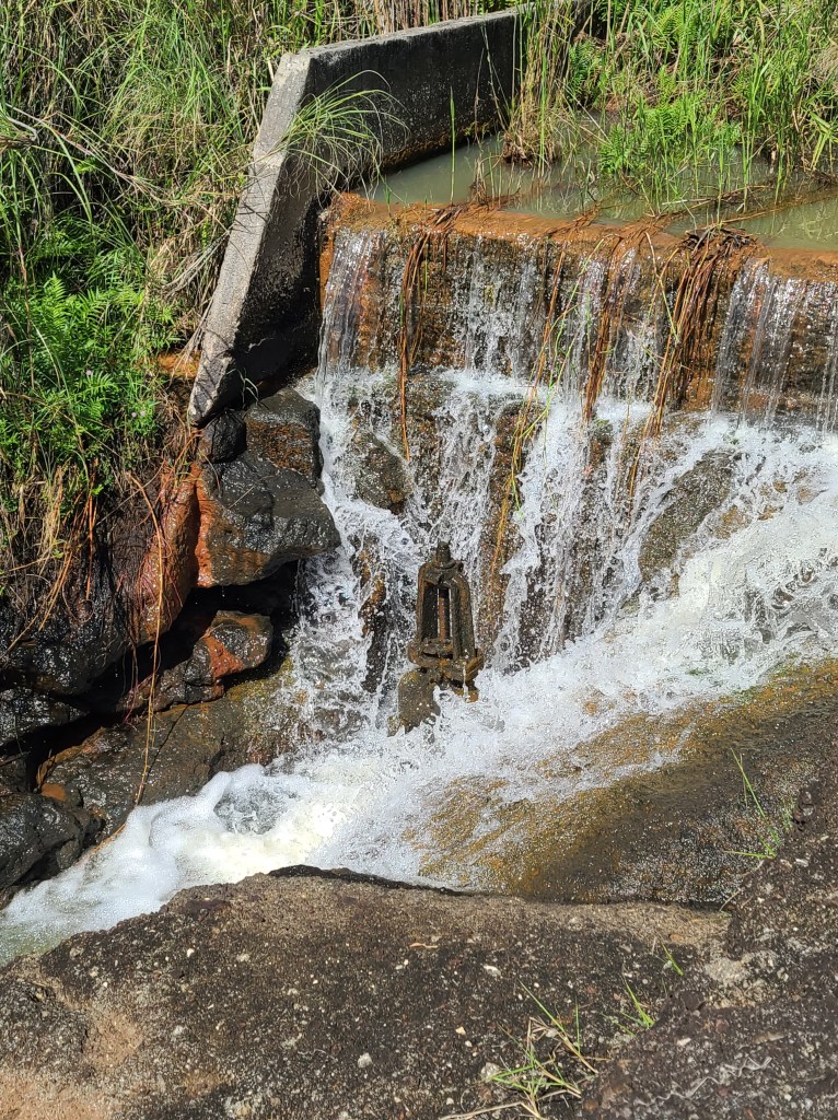
Fintasa. This is the same trail head for Inarajan Falls and LaLao falls. This is maybe my least favorite falls of all the ones on Guam. It took me three different hikes before I was able to find it. And even so, I am not sure I could find it again (or describe where the road forks to the right). The falls is below a dam and is downwind from the landfill, and as a result, did not feel like the clean and pristine Guam I am used to. Of course the falls were beautiful but nothing particularly special compared with other hikes.
LaLao Falls. This the same parking and trail for Fintasa and Inarajan. Don’t make a special trip for LaLao. But if you are hiking Fintasa and/or Inarajan then this is an easy side trip. Once you get to the bottom of the hill, before turning right to cross the river for Fintasaa or Inarajan, turn left and take a right turn soon after.
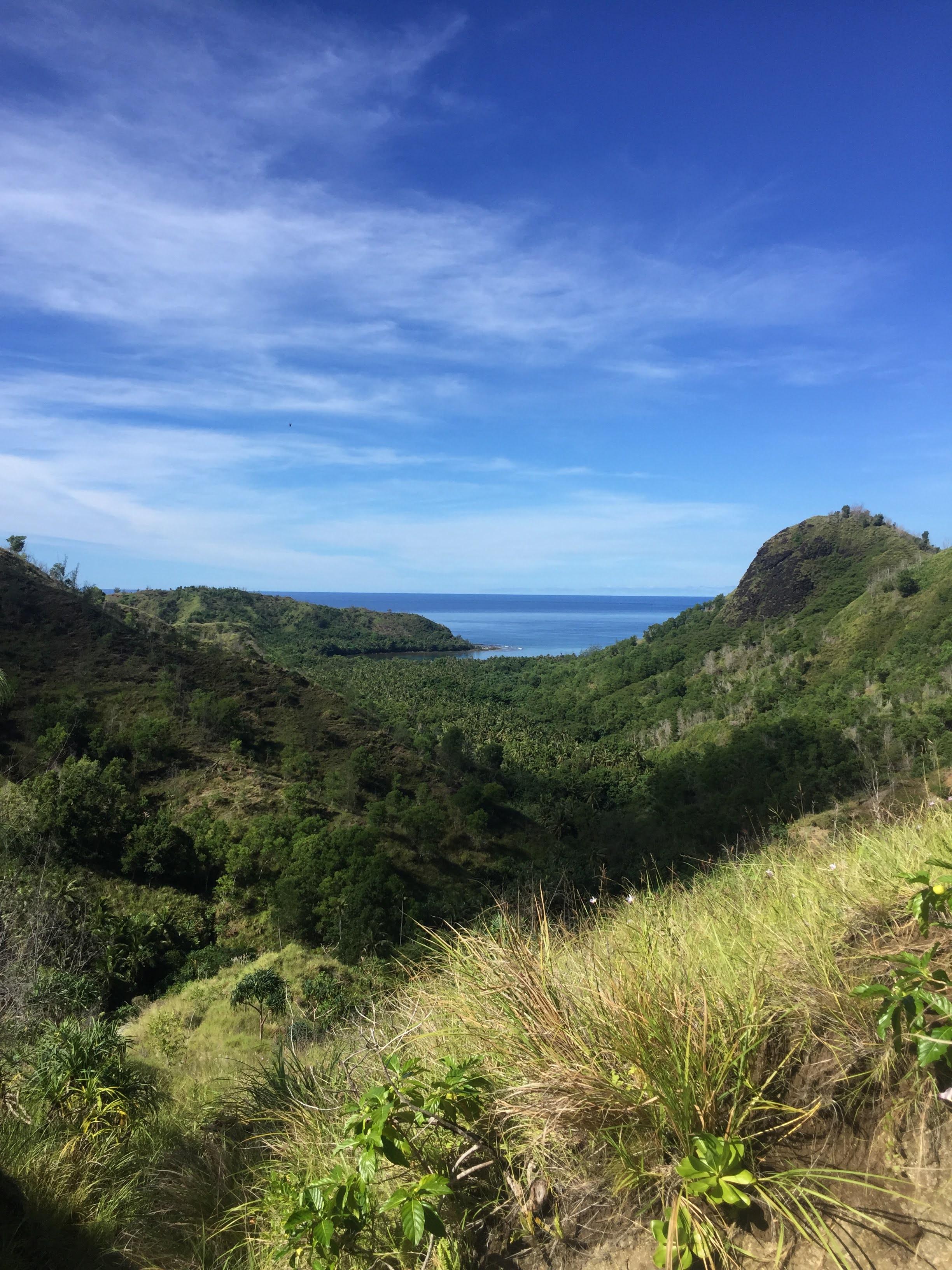
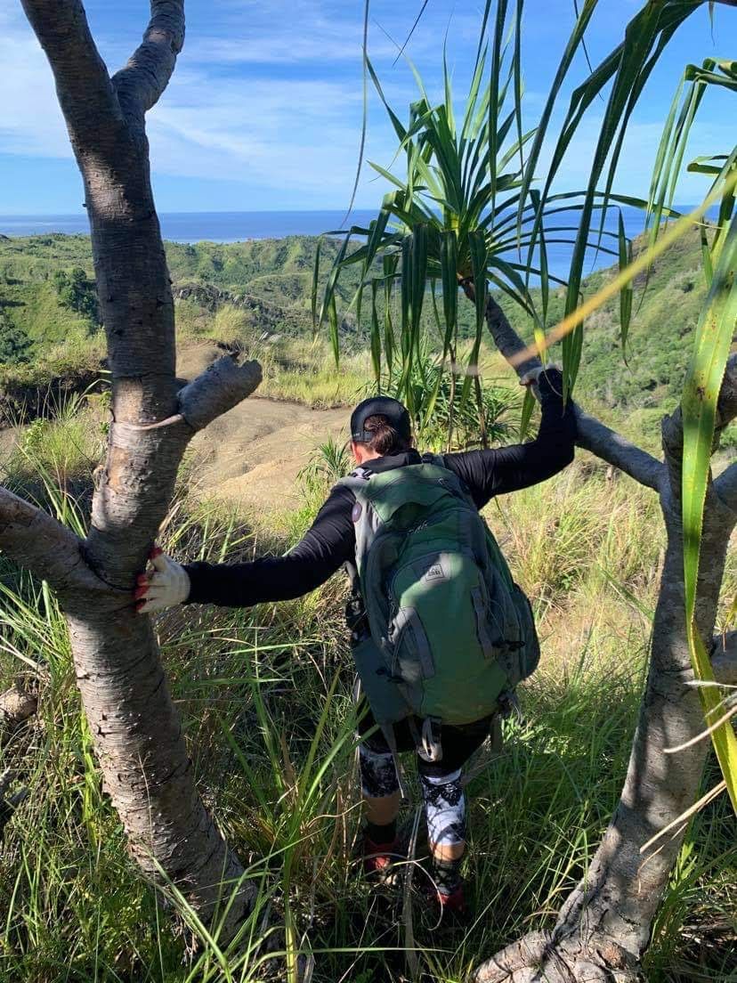
Guatali Falls. This is one of the hardest hikes I did in Guam. It is long, exposed and a tough steep climb on the way out. But on the flip side, it has an amazing, unique view of the harbor and you get to see four waterfalls. The trail head is the same as Upper Sigua and Maguagua. However, once you park, walk straight to the end of the street and you’ll see a trail straight ahead. The first mile is flat and easy. Once you come to the ridge you want to turn right and then follow the ridge into the valley. This is the hardest part to find and even with a map, we got turned around. The walk down is steep with loose rocks. The walk up is brutal. I’ve spoken to others who have done this and we concur, it wasn’t worth it.