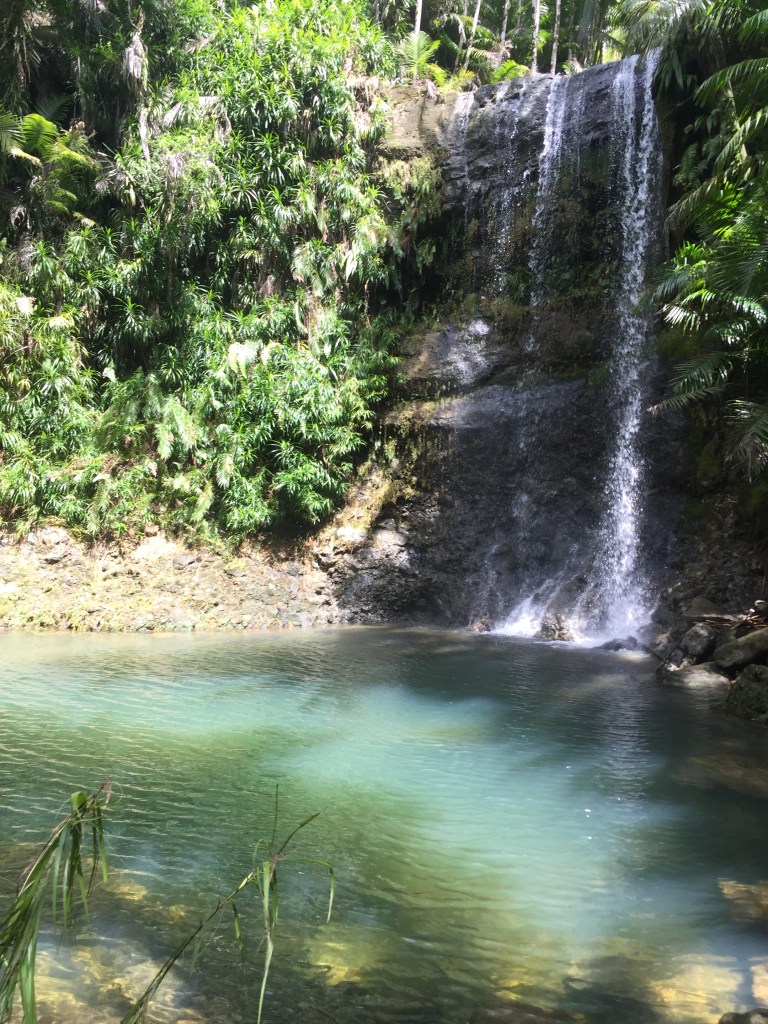
San Carlos Falls was recommended to me by a friend of a friend. The first time I went, we got turned around several times (at least 4) so I definitely recommend hiking with someone and using All Trails or another GPS map to make sure you don’t get too lost. San Carlos Falls feels like you are the first person to ever explore the area. You descend from Nimitz Hill to the oasis of jungle and palm trees. About half of the hike is walking through the water. Wear boots (or sturdy shoes) but bring water sandals or water shoes. You can either do the hike as an out and back or as a loop. I think the loop is much better. When you descend down the ropes to the river, head downstream (don’t be led astray by other trail markings). When you reach the top of the falls, look for the path on your left. Don’t jump – it is NOT safe. You will head up a steep hill followed by many steep declines. You are now at the bottom of the falls and in a secluded swim hole. If you want to continue on the loop to the swim hole, walk down stream (there is also a path on the right bank but I prefer river walking). When you reach the fork in the river, head upstream about 15 minutes. This swim hole is almost as fun as the falls. To head back, on the far left of the falls you will see a rope. Climb up but then cross the river to the right side where you will find a path out of the jungle. We took about 4 ½ hours on the hike but did do about 1 mile extra in getting turned around. Trail head parking is 13.45267, 144.71635.
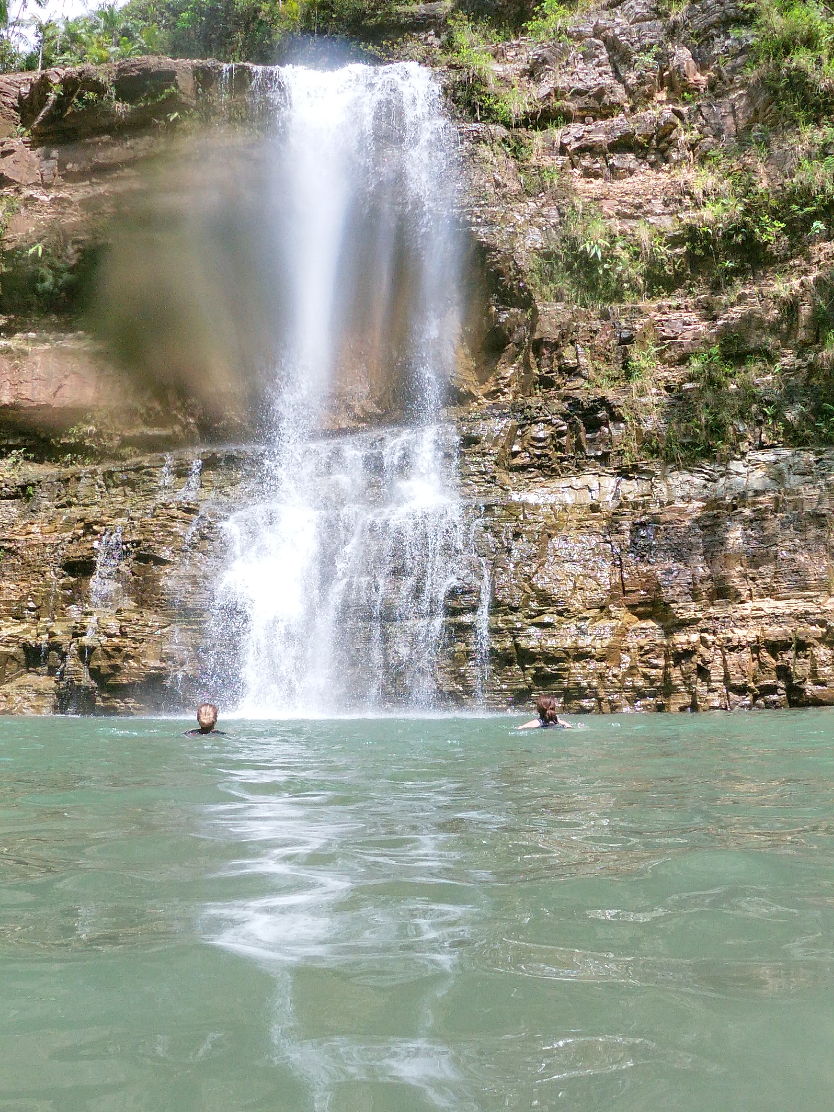
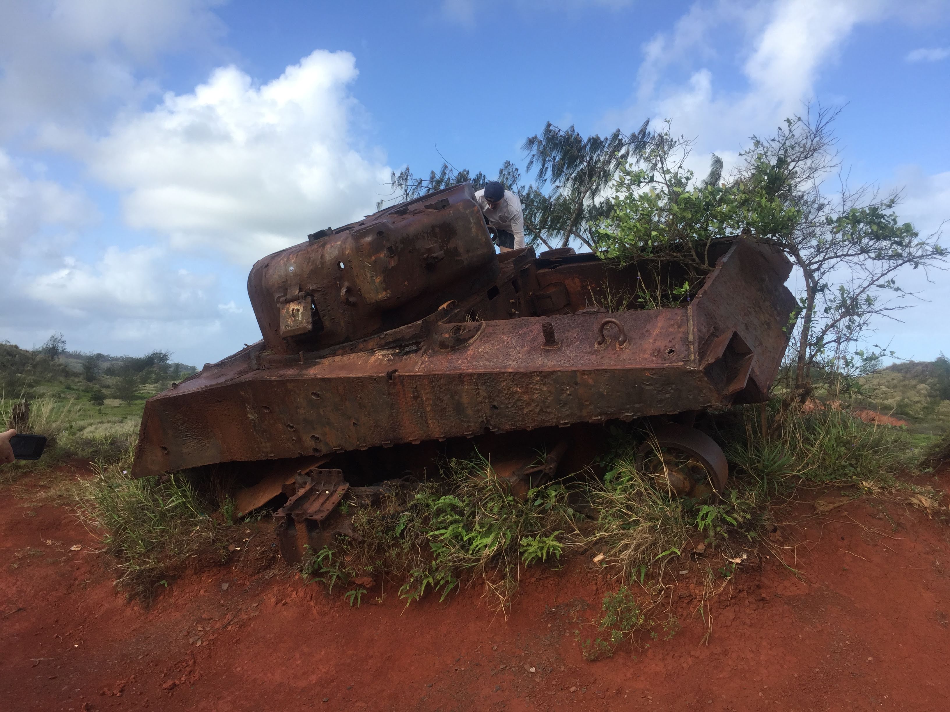
Lower Sigua Falls is fantastic. You will need 3-4 hours. It is a little more exposed than other Guam waterfall hikes and prepare to get muddy during rainy season. But it is beautiful, you will come across some WW2 tanks and the falls are magnificent. The first half of the trail is very flat and easy walking. The second half is steeper with a river crossing and ropes. There are a couple of confusing spots so make sure to go with someone who has been before or download the All Trails map which is pretty accurate. You can get to the falls from either Upper Sigua trail or from Leo Palace. I recommend starting at Leo Palace. Park along the road right before the gate along the jersey barriers. You can either hop the jersey barriers and find the trail, or it is easier to walk up to where the fence begins, and then walk along the inside of the fence for a few minutes until you see the trail on the right. The trail runs parallel to Leo Palace for quite a while.
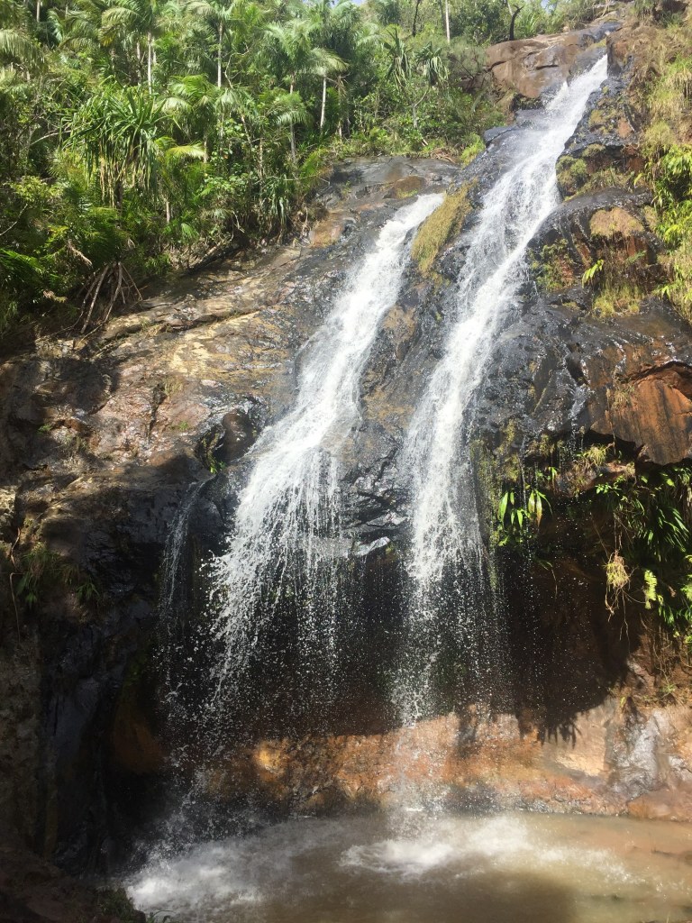
Upper Sigua Falls is a great hike. You start out with amazing views of the Southern Mountains and ocean. You then descend down to the river. It was very muddy my first trip and I did much of it on my butt. Towards the bottom you will come to a fork. Go right for Alutom Falls which only adds an extra 5-10 minutes to your hike and is worth it. Return to the fork and go left for Upper Sigua Falls. At the top of the falls, cross the river and head down. It is steep but there are ropes to help. These are two beautiful falls. Not my favorite but definitely worth the time and effort. The trailhead is at 13.43654, 144.70761. At the end of the road, turn left onto the gravel road. Park across from the water tank. You can also drive further up the road towards the towers (I was a little worried the road would become too muddy so I stayed closer to the main road and walked.)
Ghost Cave and Rock. This can be done as an easy out and back. But of course, that is not how we did it, nor how I recommend it. Most say it takes about 3 hours, but we got turned around a few times and it took closer to 4 hours. The trailhead is at 13.3914310,144.7153970, very close to Tarzan Falls. Park near the Santa Rita sign, cross the road and walk 1-2 minutes toward Tarzan Falls. The trail was well marked when I went. The water was high enough during dry season, I would not go in the summer. The first bit is an easy walk through the forest and then through the grasses. You can either then just walk straight through the grass or take a sharp right towards the river. Once you hit the river it is a long river walk until you take go up the bank on the right bank. Then comes the fun of crawling through the cave and dropping down to the river again to Ghost Rock and cave. We went through the cave but looped back around to head down stream. I think we should have just gone through the cave and then back up the hill to grass where you started. This is more of an adventure than a hike. I would recommend long sleeves and lots of mosquito spray. Try to get a recording from someone if you can.

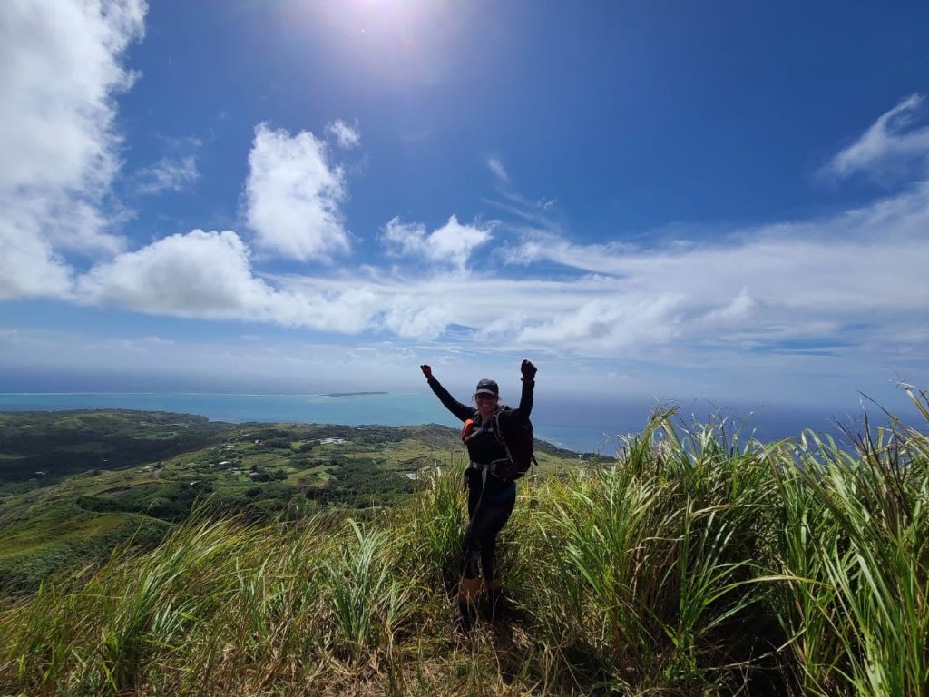
Mt. Schroeder. There are several ways to hike Mt. Schroeder. I did it a couple of times as part of Southern Mountains. You can also hike it from Priest Pools. This is the easiest and most straight forward. Finally you can tackle it from the West at Umatac Power Station. This is face is more exposed and will be more difficult to climb. The summit provides gorgeous views of gat, Cocos Island and the Valley. The Spanish name translates to Christ’s Point.