
Guam has amazing hiking. However, be careful, even though Guam is small, it is not unheard of for people to get lost, hurt or even die when hiking in Guam. The best way to hike is in a group. If you are here on a Saturday you can join with Boonie Stompers (check out their facebook page). They meet at 9 am at CHumorro village and it costs $5 to participate.
However, COVID lock down hit shortly after I moved to Guam. And after being cooped up for a few weeks, I had to get out. A partner of a co-worker leads hikes and so I asked for a list of hikes that I could do safely by myself. Those, as well as a few others are detailed below.
If traveling to Guam and you want to get out for a few easy hikes on your own, I recommend choosing from the list below. All of these are non-technical well marked hikes. They are all also less than 3 hours total including a little time to explore. I have listed them in order of my favorites, but you may want to pick and choose based on location or other factors. Again, hiking alone is not recommended, so let someone know where you are going and make sure to have a GPS. I also recommend the All Trails app.
If you are limited on time, I recommend you pick Mt. Lam Lam and either Sella Bay, Pagat Cave or Anao. I did each of these hikes multiple times. They are classics for a reason.
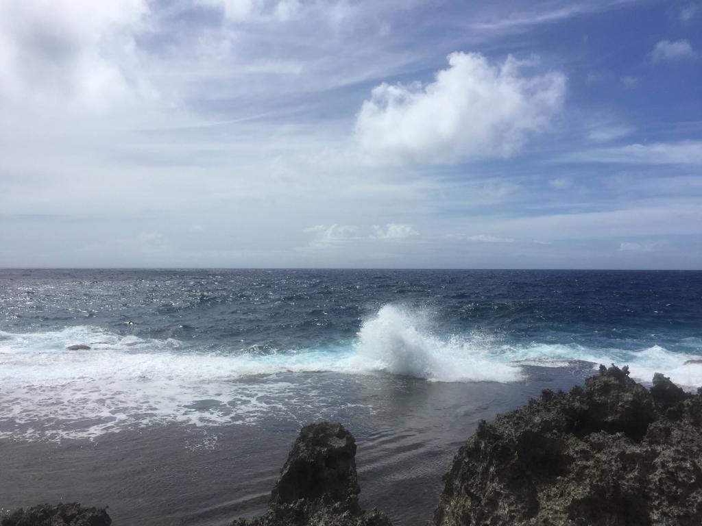
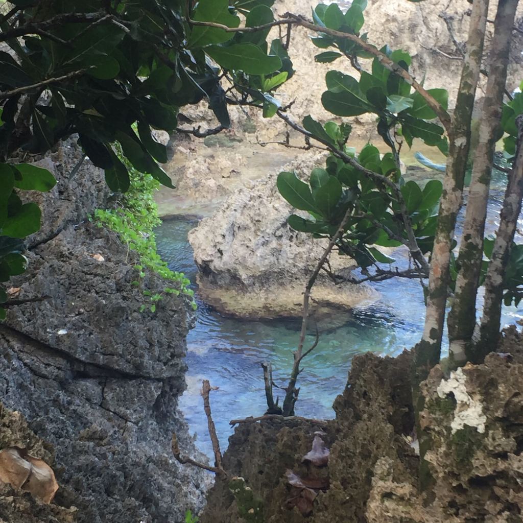
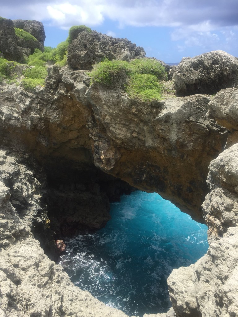
Anao. You can do this out and back hike in less than 90 minutes or take most of the day to explore the coastline. The first half of the trip is relatively flat walking on coral. I have weak knees and ankles so I almost always wear boots, but I’ve seen folks in shorts and tennis shoes. At the end of the flat portion there is a wonderful overlook from the top of the cliff. If not up for more, you can turn around here. It is another 20-30 minutes down the cliff to the coast. It is not difficult but I took my time. It is worth the trip, and the coast is spectacular for all 5 senses. Even the sea spray felt different. Take time to explore the area – north to Anao Point and south to Mati Point. This area is not safe for swimming. The trail head was easy to find and the trail is very well marked. In fact, I did it by myself multiple times and I am pretty directionally challenged. The hill is steep but I didn’t need gloves. GPS for the trail head is: 13.546190, 144.9294210
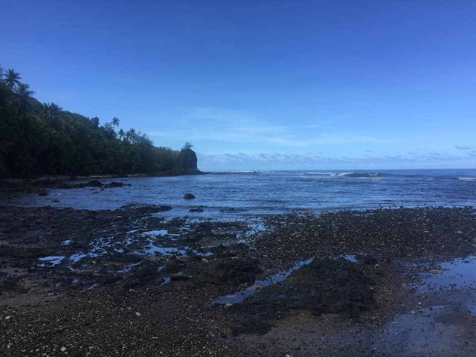
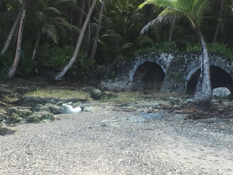
Sella Bay. This is by far one of my favorite hikes on Guam. The views are beautiful and you end up at an old Spanish bridge and an amazing beach. The hike is well marked and relatively easy. It is ok for both kids and dogs. It took me 45 minutes each way and I spent about an hour exploring the beach. But I could’ve hung out much longer. GPS for the trailhead is 13.33713, 144.65915.
Pagat Cave This is a magnificent hike. The first half of the hike it relatively flat before you begin to descend. Be careful in the rainy season as the rocks will be slick on the way down. I was able to wear shorts but was glad I had my boots. The rocks are sharp and on the way back up I was glad I had gloves. The first time I did this hike, I missed the cave. The second time, I did a lot of research and fortunately it was well marked. Essentially, you will be hiking down for quite a while and before the trail ascends again you will come to a plateau. If you were camping, this is the spot you would pick. To your left, there is a cave. You won’t see water and frankly it is not somewhere I would have ventured if I didn’t know it was a thing. You will walk through the cave and then use the rope to go down further. It is then you can switch shoes for the water and leave your backpack. It was a lot of fun to just swim around the dark underground cave. Please note there are two rooms to explore. You will need a waterproof flashlight for the cave. Don’t go into the cave without some sort of light!! After the cave, continue up to the coast line. On your way back, as you enter the jungle, keep your eyes peeled to the right and you can see some old latte stones. GPS for parking and trailhead is 13.49995, 144.87714. Just park on the side of the road.
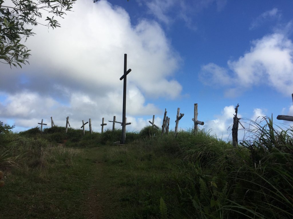
Mt. Lam Lam. Even if not much of a hiker, Lam Lam is the one essential hike while in Guam. 1) Many claim (embrace the myth) that Lam Lam is the tallest mountain in the world. The mountain’s base begins miles below sea level in the Mariana Trench. 2) This is the hike to do in Guam and loved by the locals. In fact, it is local tradition to hike the mountain on Good Friday and as such the path is lined with crosses, representing the stations of the cross. 3) The crosses make outstanding markers to know exactly how far you have gone and have left to go – making it very kid and non-hiker friendly. 4) The views are AMAZING! You can see the hills of SW Guam and see the ocean on both sides of the mountain with a 360 degree view.
The hike is relatively easy, it took me and my husband (who is not a hiker) 45 minutes each way. The first little bit is actually the steepest part of the hike, so don’t let it scare you off. Once you get past Cross IV, it is less steep. The hike is pet and kid friendly with no need for ropes or gloves. I always wear boots but my husband wore tennis shoes. There is a lot of sword grass on the hike so pants can be a good idea if you have them but not required. GPS for the trailhead is 13.33783, 144.66669. Park on the right at Cetti Bay Overlook (make sure to climb the stairs for a quick view) and then carefully cross the street to the trail head.
Note: Sella bay and Mt. Lam Lam are easy to combine (same parking area) and I would follow the hikes with lunch at the Marina Bay Grill just up the road.
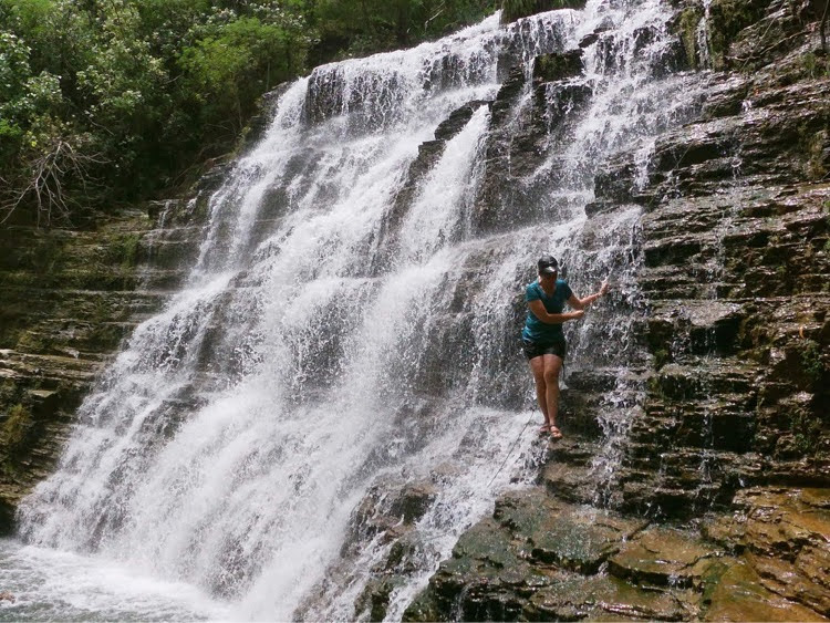
Tarzan Falls. I have done this hike a couple of times. I was not impressed the first time during the dry season. However, the falls were magnificent in the rainy season. The catch is the trail was much more slick and harder to navigate. That said, it is still one of the easier hikes on island. And even when it is slick, it is not dangerous. This is a local favorite most locals have done this hike at least once as children. It is relatively easy and it took me 90 minutes with my dogs and husband who don’t hike much. My dogs got overheated so it took us much longer than it would someone relatively fit. The hike is not that pretty as there was a recent fire and much of the jungle was destroyed. But about half the hike is flat and the other half is down (then up on the return). My husband was fine in shorts and tennis shoes. There are some ropes but you will only need them if it has recently rained. The falls are pretty and resemble something out of the Tarzan movie (hence the name). Not my favorite hike in either season, but so short that it was worth it to see the falls. You can find the trail head at 13.388000, 144.722220. Parking is on the right hand side of route 17 near the turbine.
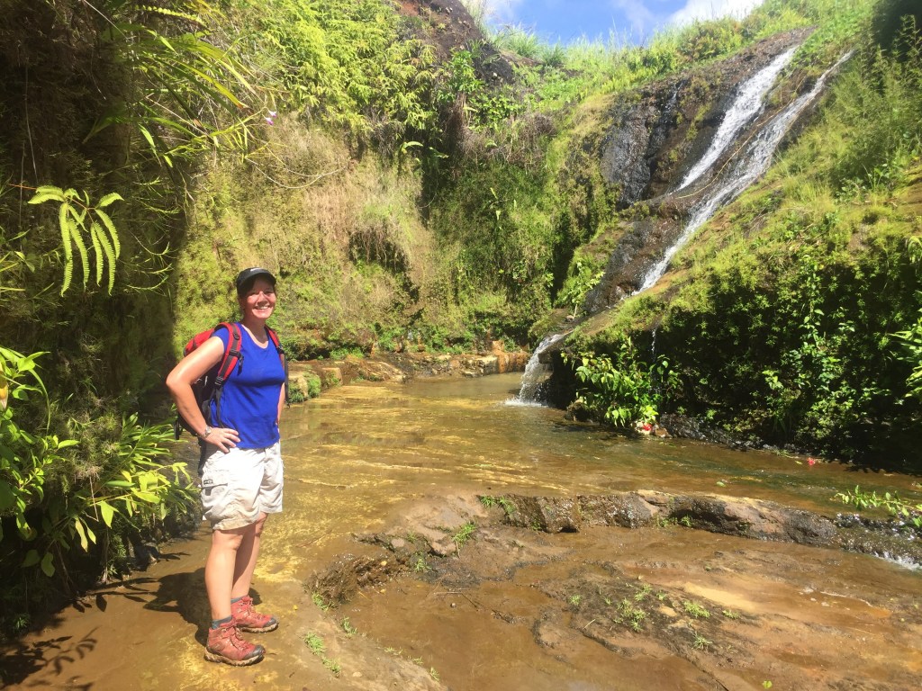
Tinago Falls This is the easiest hike I’ve done on Guam. It is exposed but completely flat except for one very short drop off at the end. It took me about 30 minutes each way. What the falls lack in size, they make up for in just the ability to enjoy them by getting in the water, the swings, and the hammock. The trail is easy to navigate on your own. There are two places you have the potential to get turned around. In general, follow the jeep tracks. At one point you will come to a plateau and view and may not be sure if you go straight or right. Go right. And then right after the small creek, turn right down the slope. Park on the road by the school. The trail starts just to the right of the large yellow metal thing (I don’t know what it is but you’ll know it when you see it). GPS coordinates are 13.28730, 144.74329.
Note: For both Tarzan and Tinago falls, this is a scenic drive. You will pass several beach parks. This hike is easy to turn into a full day if you combine it with Priest Pools, Latte Stone Park, Gadao Cave and/or a meal at Jeff’s Pirate Cove.
